PROLOGUE
Having not seen my friend Ben in a few years, and now both living in the same country for the first time in the same few years, we made plans to meet up for a bushwalk. After some discussion, we decided on an area neither of us had visited before: Wilsons Promontory National Park, a pendant of granite dangling off the south coast of Victoria east of Melbourne.
There are a few different options available for overnight bushwalks in Wilsons Prom; the Northern Circuit is one of them. Parks Victoria's info sheet describes this one as "a challenging walk, even for experienced hikers", and requires that bushwalkers complete a self-assessment form before they will issue the required permit for overnight trips. I phoned the Tidal River office to ask for copies of the forms and to get the latest information on track conditions and water availability (an especially important bit of information, given that I am no longer living in New Zealand, where you can count on finding water almost everywhere you go, any time of year). The ranger I spoke to wasn't able to give me much up-to-date information, given that no other bushwalkers had been in the area for a while, and that it'd been months since staff had been into the depths of the northern wilderness. I was advised to seek out recent trip reports online.
Close to half of the Prom is managed as a wilderness zone, and this zone encompasses the full length of the Northern Circuit. Reading the trip reports Ben and I found online, I gathered what information I could on reliable water sources and track conditions, transcribed the local tide charts onto my A3 printouts of the relevant topo maps and made plans to meet Ben at Tidal River on the evening of Tuesday the 10th of February, in preparation for a start early on Wednesday.
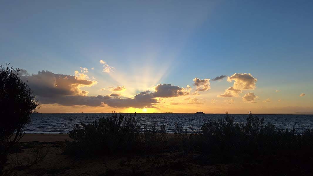
On Tuesday, I drove about six-and-a-half hours from Gunditjmara Country through Melbourne, saw a few emus on my way into the national park and arrived at Tidal River in the late afternoon, with enough time left in the day to hoof it down to Norman Beach for a swim. The beach was chockers, and the campground the same; you wouldn't know it was the middle of the week and not school holidays any longer. Ben arrived about an hour after I did, and we went back down to the beach after setting up camp to enjoy the sunset, stopping to admire the sedate grazing of a local wombat on the way.
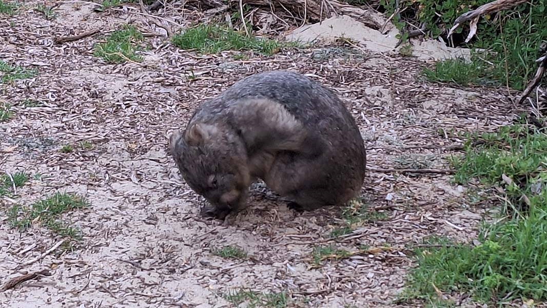
Above: The wombat itself
DAY 1 - 11 FEB 2026
FIVE MILE ROAD TRAILHEAD to JOHNNY SOUEY COVE (via FIVE MILE BEACH)
I woke up on Wednesday morning properly around 6 o'clock, having been startled awake a few hours earlier by one of our campground neighbours waking up screaming. We drove to the Five Mile Road trailhead after packing up and got on the way at 7:30. The first part of the walk was a hot slog along the 16.8-kilometre length of Five Mile Road, named not for its length but for Five Mile Beach at its terminus. Five Mile Road is a well-graded gravel fire trail and was easy walking, but we both had heavy packs on, with four days' worth of food and as much water as we could carry. I'd recently acquired a 4-litre water bladder and started the day with it full, supplementing the two 1-litre Nalgene bottles I'm accustomed to carrying. Ben was carrying 3.5 litres of water. Given the late-summer lack of certainty around water, we decided that we would carry as much as we could to start with and if we couldn't find water at Five Mile Beach, we would have enough to get us through the night and could bail the next day if need be.
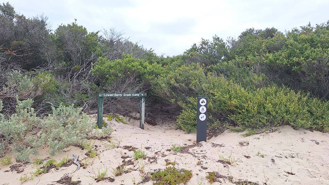
We passed the turnoff to Lower Barry Creek and proceeded past Barry Creek Camp without stopping in for a look. Yellow-tailed black cockatoos and swamp wallabies were in abundance. Along the way, we found good-quality water where Five Mile Road crosses the headwaters of Chinaman Creek. We hit the beach around noon and stopped for a rest in the shade of the tea-trees by the banks of Miranda Creek, near the Five Mile Beach camping area.
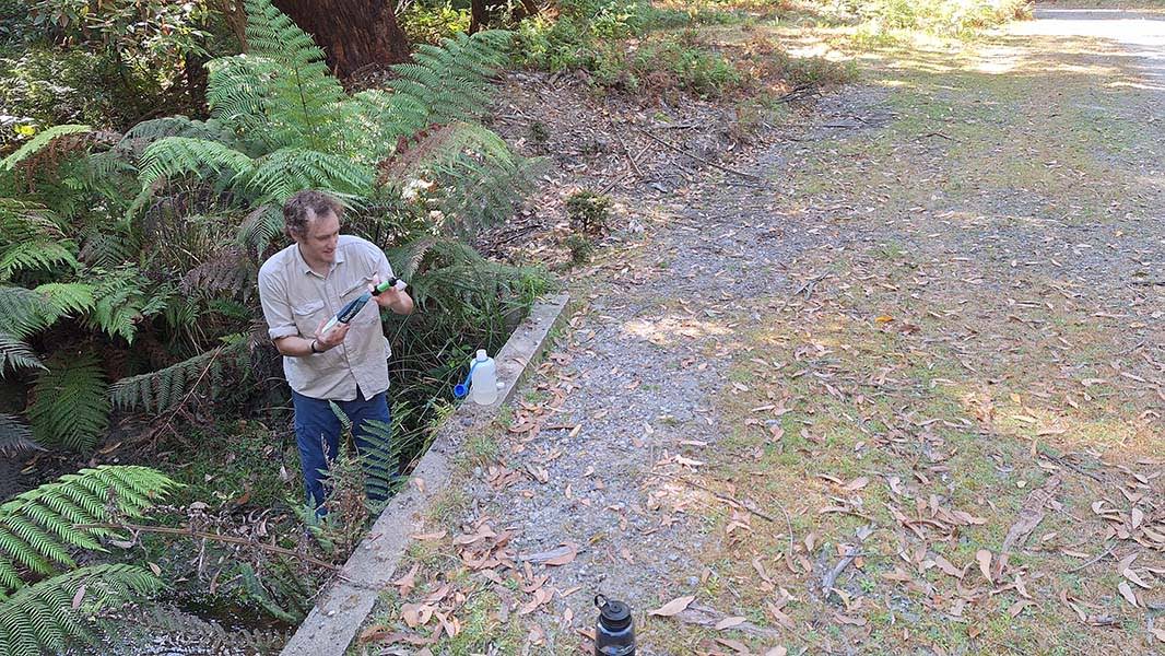
Above: Ben collecting water at the headwaters of Chinaman Creek
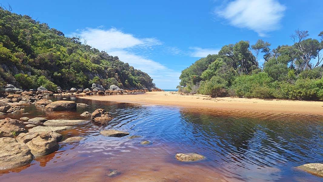
Above: Miranda Creek at low tide
We'd arrived right around low tide, and the creek was easy to cross near its mouth, but a little further upstream the depth of the tannin-stained water was hard to judge, and I ended up getting wet up to mid-thigh crossing the creek to check on the water source our research had indicated. The track to Johnny Souey Cove, our destination for the first day, was marked by a small rock cairn on the true left bank just across from the camping area, and we found a trickle of fresh water running from a gully around 40 metres upstream of here. Only after crossing back over did I realise that I'd left one of my maps in my pocket, and although I was able to salvage it and dry it out, I wasn't able to do so without it tearing in half.
Still with plenty of water, we were put off by the steepness of the slope at the start of the track and made what ended up being a poor decision to try to get to Johnny Souey over the rocks. This was fine to start with, but the granite was radiating a lot of the day's heat back at us, and the going was slow and physically demanding, requiring us to carefully clamber up and down huge sloping boulders. After a couple hours, we'd made it past Miranda Bay, where in the sand we saw what I think must have been the remnants of the bay's namesake shipwreck (see entry for the Miranda on Victorian Heritage Database here), and around the rocks of Monkey Point. From here, we could see a small beach and then more rocks stretching for more than a kilometre to the north. We made the decision here to bail through the scrub and try to rejoin the track over the headland.
Above: Shipwreck at Miranda Bay
Following at first a densely-vegetated gully uphill and then following animal tracks that let us in the same direction, and eventually wading through thick tea-tree scrub over our heads, we reached the track, having travelling around 300 metres in about an hour. I was glad that I'd brought thick leather gloves with me; my hands would have been torn to shreds otherwise. The track itself was a breeze: barely visible from eye level through waist-high heath but clear and open to shin-height (or, I suppose, wombat-height). I found myself wishing we'd just taken the track in the first place and saved ourselves a couple hours. We arrived at Johnny Souey Cove at around 16:30, passed the official camping area and set up at the gorgeous boaters' camp down by the beach. Collecting water was a priority now; I'd already drunk my full 6 L of water.
Two streams flowed down onto the beach at the southern end of Johnny Souey Cove. The southern stream looked like it would be washed by the sea at high tide, and the water was brackish, but the northern stream, flowing out across the sand right by the camp, was full of clear, good-quality fresh water, although it was deeply tannin-stained and had a distinct mouthfeel — that's the best way I can describe it.
I was just getting ready to start making dinner (spiced rice and chickpeas with fried halloumi) when it started to rain. I quickly packed up and we dove into our tents, but the rain didn't stop, so after about 45 minutes of waiting, I emerged with my raincoat on to finish cooking. We ate in our tents, and the rain stopped around 20:45.
DAY 2 - 12 FEB 2026
JOHNNY SOUEY COVE to TIN MINE COVE (via THREE MILE BEACH and MOUNT MARGARET SADDLE)
I woke up the next day to calm, clear weather, and got up to wash last night's dishes and start drying out my wet things. We proceeded to get hit by waves of sunshine and rain over and over, which was very frustrating. We even got hailed on at one point, thankfully after our bags were packed and tucked under rain covers. With our water supplies fully topped up, we left our camp at 9:30. The track that climbed up the hill at the end of the beach was hard to distinguish from the wombat tracks, and before long we lost it and ended up scrub bashing down to the rocks at 454884 E 5696124 N. These rocks were much easier to traverse than yesterday's rocks.
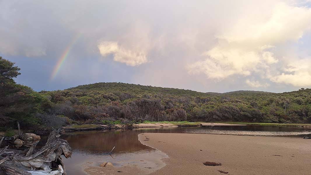
Above: Rainbow at Johnny Souey
Above: A wet Ben at the Johnny Souey campsite
Getting around to the next beach — a small beautiful one just south of Three Mile — I felt something dripping on my lower back and opened my pack to find that my new water bladder was leaking, and had dribbled about 400 mL of water into my pack. At the next rocky headland we stopped on a relatively sheltered slab for lunch, because the wind was starting to pick up. I unpacked all my gear to dry it off in the sun. I used my bladder to fill up all our bottles and kept the remainder in a mesh pocket on the outside of my pack to lessen the threat of continued leakage.
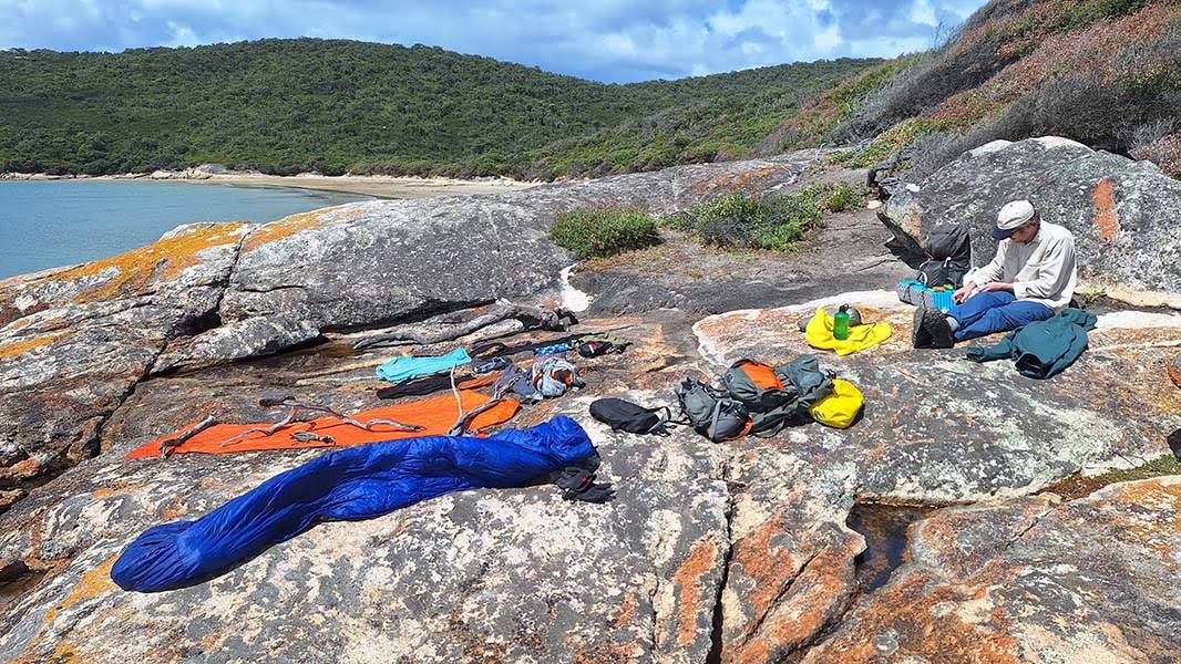
Above: My gear drying on the rocks at lunchtime
We walked up the length of Three Mile Beach, doing our best not to disturb too much the hundreds of thousands of soldier crabs which teemed on the exposed wet sand below the high tide line. The light station at Lighthouse Point came into view, and I knew from my reading that we were looking for a V-shaped gully, possibly with a rope in it, to lead us up to the next section of track. The gully was impossible to miss, and the rope was there too, a climbing aid with a buoy attached to the bottom end.
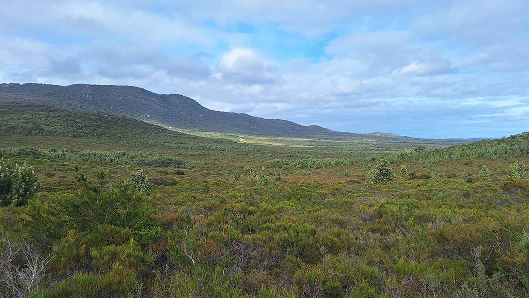
Close to the light station was a recently cleared helipad — the foliage of the cut and piled tea-tree saplings was still green — and beyond that, an obvious track through the head-high scrub. By most standards this track was pretty overgrown, but it was easy to follow as it climbed slowly to the broad saddle between Mount Margaret and Mount Hunter, and there were even very occasional markers in the form of orange triangles and flagging tape. It was on this section, too, that I started to see chunks of grey and green foam courtesy of some unfortunate soul's yoga mat. Navigation across the banksia and grass tree scrub of the saddle itself, and we lost our way a few times, having to backtrack or go cross-country to find the track. It was slow going, and with some stops to rest along the way it look us 3.5 hours to get to Chinaman Long Beach.
Above: Conditions on the Mount Margaret Track
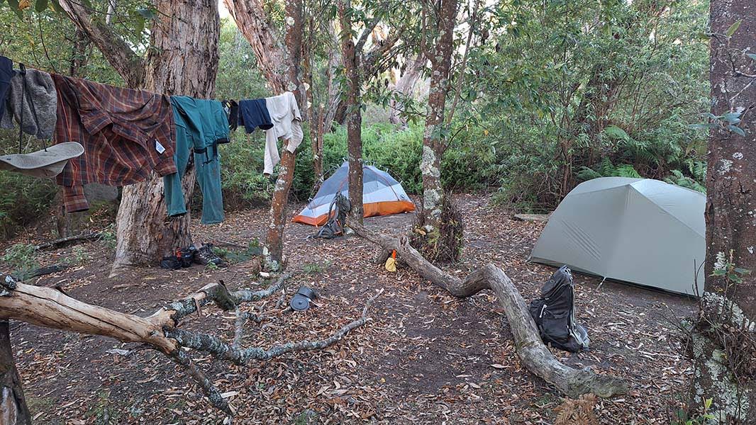
We arrived here on the other side at around 17:00, and headed up the beach towards the Tin Mine Track. I was surprised to see a large mangrove growing on the wet sand at the north end of the beach. The track to Tin Mine Cove was shockingly well-maintained, and it looked from the vegetation on the sides of the track that it had been cleared within the last few months. Still, we were both knackered, and I had a burst blister on my left heel that was giving me grief. The official camping area was perched in melaleuca forest high above Tin Mine Creek, and although it was sheltered from the building westerly wind, Ben and I decided to camp on the beach to be closer to the water supply.
We found a spot a little north of Tin Mine Creek with space enough for our two tents and a little sheltered area for cooking. The water from Tin Mine Creek drains from a swamp and was clear but flowing sluggishly, and I was careful while collecting water not to disturb the detritus sitting on the bottom. For dinner, Ben made a delicious daal with lentils, dried peas, pappadum fragments and the caramelised onions I'd forgotten to add to the previous night's dinner.
I brought my sketchbook and a deck of cards along, but every night thus far I had been far too tired to stay up for long, and the wind at Tin Mine Cove made cards out of the question, but I did tell some tales and talked with Ben about Beanie Babies and raw denim before bed.
Above: Sunset from Tin Mine Cove
DAY 3 - 13 FEB 2026
TIN MINE COVE to LOWER BARRY CREEK CAMP (via CHINAMAN LONG BEACH and CHINAMAN SWAMP)
The wind died off sometime in the night, and I woke up at 3 o'clock in the morning to the sound of a speedboat way across the water. I got out of my tent for a quick look at the stars and saw that the sea was dead calm. I woke up later to Ben shouting and the sound of an animal colliding with his tent fly. He reckons it must have been a feral cat jumping onto his tent — we saw plenty of cat pawprints on the beach later in the day. We had another fairly relaxed start. As Ben filtered water from the creek and I packed up, I first heard and then saw a pod of dolphins swimming off the coast. We set off back over the hill at 8:30 and got back to the Johnny Souey junction at 9:05.
Above: Tin Mine Cove camp
Above: Tin Mine Cove from the track
We hit Chinaman Long Beach pretty much on high tide, but the tide rapidly dropped as we walked along. After just shy of an hour, we arrived at the end of the beach, where the continuation of the track, through Chinaman Swamp to Lower Barry Creek was clearly marked by a wooden sign. Both of us had read up on trip reports online, and I thought I had a good idea of what to expect: thick scrub, challenging navigation and potentially very deep mud. The first two we'd had a taste of already, and given the recent dry weather we didn't expect to encounter too much mud. We were largely right about the mud, but otherwise, reading trip reports truly can't prepare you for this section. This kind of hell has to be experienced.
We headed into Chinamans Swamp at 10:15 and didn't stumble into our campsite at Lower Barry Creek, 7.5 kilometres away, until 17:30! Seven hours in the swamp!
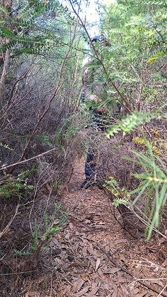
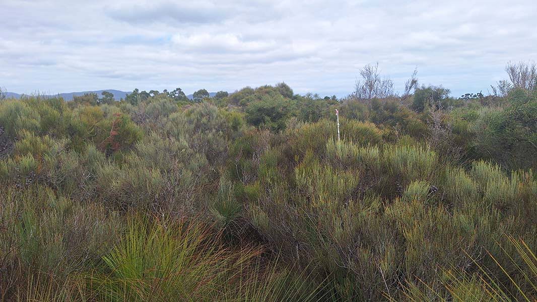
Leaving the beach, the track quickly degenerated, becoming impossible in many places to distinguish from animal tracks. It was incredibly easy to lose the track, especially in the banksia and grass tree groves scattered across the generally waist-high to head-high heath. We had occasional markers in the form of old pink and orange flagging tape, much of which was crumbling and faded to white, and which was sometimes only visible as fragments at ground level, along with orange plastic star pickets and thin white fibreglass poles. These markers weren't frequent enough to consistently use for navigation, only for reassurance that we were still on the "track". Many times we lost the track and had to backtrack, one of us retreating to the last marker as a kind of anchor and the other searching for the next one. A rusty sardine can and more yoga mat fragments also provided us with helpful traces along the way.
Above: The start of the track, at the end of Chinaman Long Beach
Above: The track through the swamp. Can you see it?
Ben also had downloaded on his phone a GPS tracklog from the Trail Hiking Australia website, which was invaluable. Sometimes we had no option but to leave our fading wombat tracks and proceed cross-country for 20 or 50 metres to try to intersect the actual track. The tracklog substantially agrees with the traces we found on the ground, and it was a relief to discover that we could count on it as a backup, but the constant focus and uncertainty was exhausting. I found myself thinking a lot about how much more unnerving this section would have been if we didn't have that tracklog. There were, however, a few brief sections before we reached Chinaman Creek where the track was obvious and we could make good pace through thigh-high or waist-high scrub.
After around three hours of largely unchanging scenery — heath, then banksia patches, then more heath, as Chinaman Knob slowly slowly swung past on our left — we reached Chinaman Creek. From our prior reading we know that this section could hold waist-deep mud at times, but we found mostly ankle-deep mud that could be easily avoided by squeezing through tunnels in the dense tea-tree scrub adjacent to the bogs. There was standing water in the boggy sections around both branches of Chinaman Creek, but you would have to be pretty desperate — and in possession of a good filter — to have a go at it.
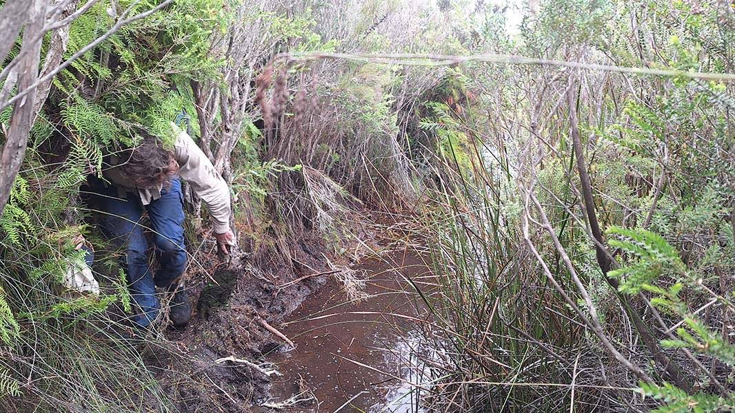
Above: Ben navigates the bogs of Chinaman Creek
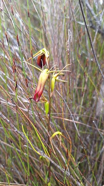
Above: Large tongue orchid (Cryptostylis subulata)
At around 3 o'clock we finally started to climb onto slightly higher ground and stopped for a well-needed lunch. After a half hour or so, we set off again. We'd hoped in vain for easier navigation now that we had a smidge of elevation, but the next two hours, through high banksia and grass tree forest, was at least less dense. At one point, I heard Ben yell out and then quickly push past me, hurrying me along. All my mind had time to process was the word "bees": somehow I'd missed the hive we'd disturbed in an old grass tree stump. Later on, we stopped to watch at least twenty black cockatoos frolicking in a group at the tops of a couple nearby banksia trees.
Above: The track opens up a little
Above: Ben and his banksia hippo
We'd been debating throughout the day about whether we would stop at Lower Barry like we'd planned or continue on to Five Mile Beach Road to stay at Barry Creek Camp instead, just to get the whole scrub section over with. By this point, the constant intense focus and the physical exertion had me feeling almost high — some kind of altered mental state, for sure. As soon as we saw the beautiful eucalypt-forest setting of Lower Barry Creek Camp, around 17:30, our debate ended.
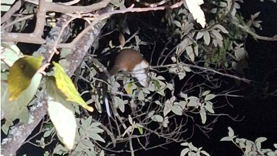
Barry Creek itself was flowing fast and cool through a little gully flanked by a narrow band of tall eucalypts, completely different to the heath and banksia we'd been battling against all day. I collected water straight from the creek without filtering it. The mosquitoes were in a frenzy, so we made dinner quickly: a freeze-dried curry for me and a bizarrely-named packet of "macc" [sic] and cheese for Ben. We were both in bed before sunset, and chatted for a while from the safety of our tents, but emerged after full dark to watch ringtail possums gallivanting in the treetops. Before going to sleep I heard the chirping of bats, the heavy wingbeats of flying foxes above the trees, and what must have been wallabies moving around in the bushes.
Above: Camp at Lower Barry Creek
Above: Common ringtail possum (Pseudocheirus peregrinus)
DAY 4 - 14 FEB 2026
LOWER BARRY CREEK CAMP to FIVE MILE ROAD TRAILHEAD
Ben and I were both up early, eager to get started. We packed up, collected water and left Lower Barry at 7:30. Finding the exact route of the track out of the gully took a bit of hunting. We emerged back into a mix of banksia and grass tree forest and tea-tree and hakea scrub. Navigation was easy all day, with bits of fresh pink flagging tape tied up in branches at regular intervals. There was only one short scrubby section (around 444421 E 5695943 N) where we couldn't rely solely on the flagging tape and had to use the trusty tracklog again.
It was while wading through thick hakea in this section (please also note that I had unwisely chosen to wear shorts before leaving camp) that I heard voices from the scrub off to our left. I let out a coo-ee, and got a response from two men in their 20s looking for the track. Calling back and forth across the scrub, Ben and I passed on what we'd discovered the previous three days about track conditions and water availability, and asked them about their route. When one of them told us they were heading for Five Mile Beach, I had to straight-up tell them that they weren't going to make it there that day. The rest of the walk Ben and I were baffled by that, and worried about those two. If they had planned on getting to Five Mile Beach from this side of the circuit in a day, did they have enough food for the whole circuit? I hope they didn't end up stuck in the swamp...
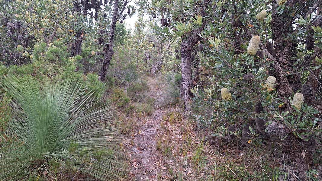
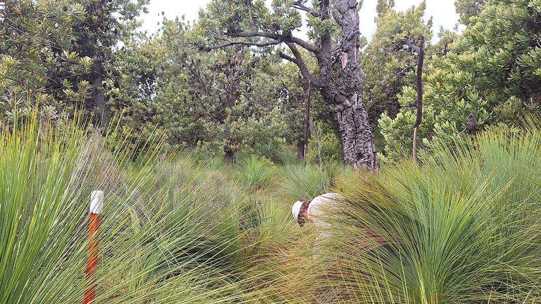
Above: Banksia forest on the way out to Five Mile Road
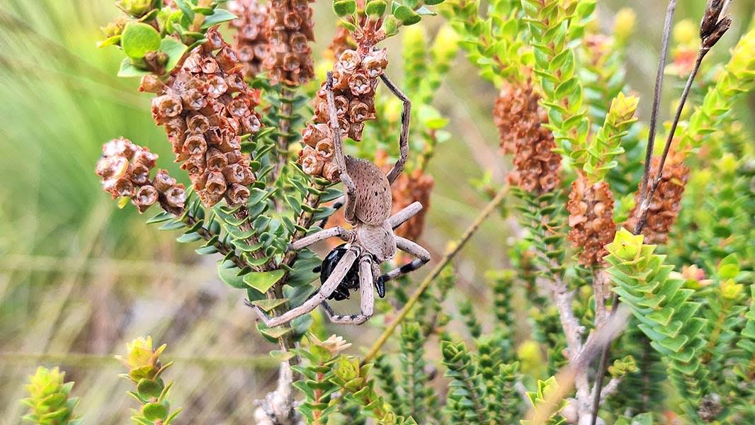
Above: Tasmanian football spider (Neosparassus patellatus)
Above: Looking out towards Five Mile Road
The rest of the way, it was an obvious track through open forest and over rocky humps. Five Mile Road, once we reached it, was a bit of a slog, but I felt surprisingly strong until the last long downhill. My feet aching and my heel raw, we reached the car park close to 11 o'clock, where I stripped off my boots and stinking socks and shared chips and Powerades with Ben.
I got changed into my clean clothes, ready for the drive back, and said my farewells to Ben. After he left, I got talking to a big group of walkers doing an overnighter to Five Mile Beach and ended up giving them the relevant half of my annotated map, the one I accidentally soaked on the first day. From there, I drove home, with a stop for a shitty takeaway burger in Korumburra.
POSTSCRIPT
The day after I returned, I wrote an email to the Parks Victoria office in Tidal River, giving them an update on track conditions and the availability of water along the circuit. I also made a request that if possible they get in touch with Land Use Victoria, the agency that produces Victorian topo maps, so that the route of the track through Chinaman Swamp, such as it is, can be corrected in future editions of the topo map, since there is currently a gross deviation between what's on the map and what's on the ground.
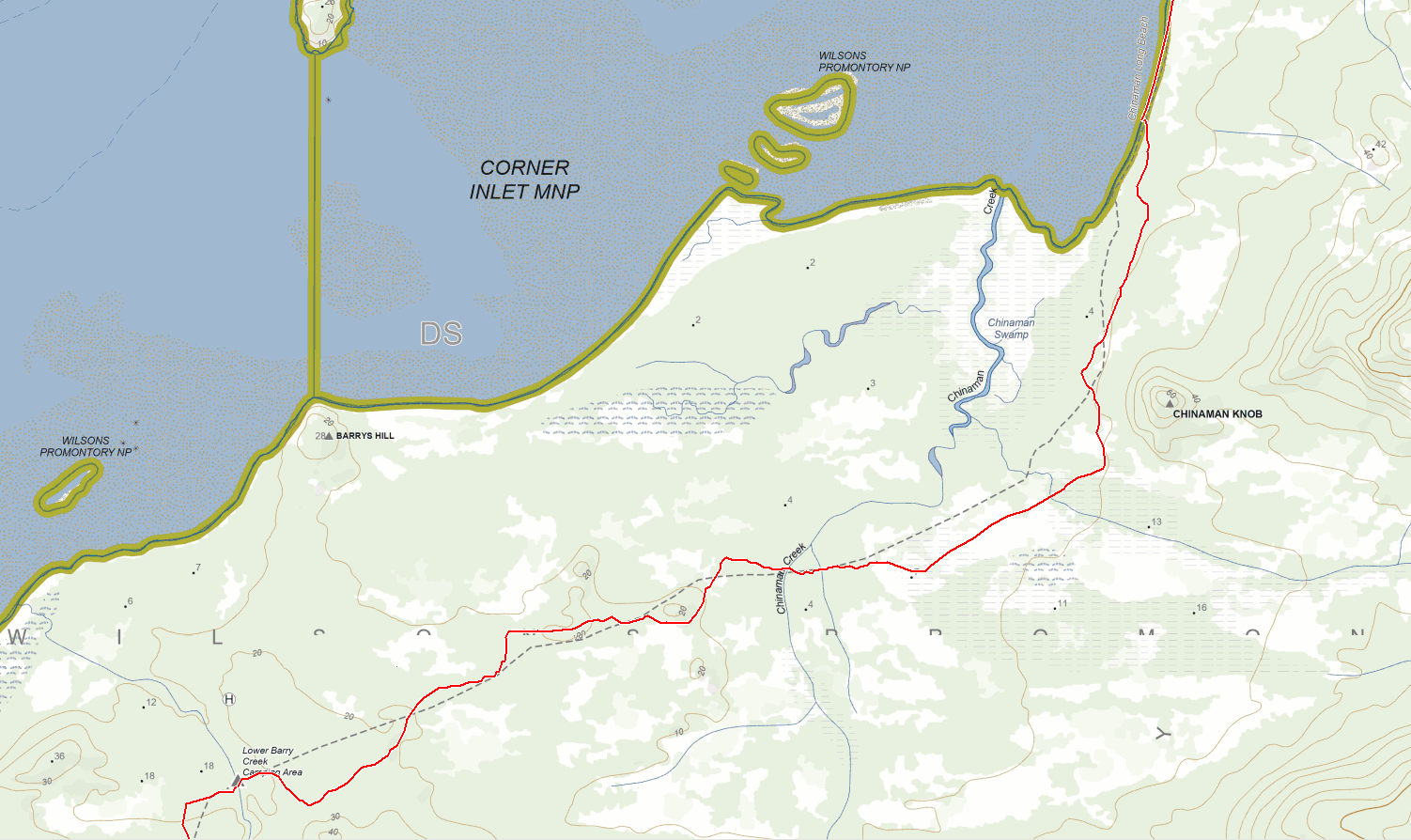
Above: Comparison of approximate route of track as marked on the ground (in red) versus the line marked on the Vicmap 1:25,000 topo map (dashed grey line)
The Northern Circuit falls firmly into the territory of Type-II Fun. I've done other walks in the past that have been more physically challenging, to be sure, but this one rates highest for the most challenging psychologically. Ben and I both felt a real sense of accomplishment afterwards. It's a beautiful area, full of wildlife and interesting plants, and the remoteness is its own reward. However, this is a trip I would only recommend to experienced bushwalkers, and one I would certainly not want to do solo. One last recommendation to punters: long sleeves and pants are a must for the scrubby sections, and gloves are a good idea too. Safety glasses also wouldn't go astray.
LINKS
Approximate tracklog of our route: .gpx download / .kml download
Parks Victoria: info page on northern Wilsons Prom walks
Other trip reports:
- 2025 report by KilgoreTroutQQ at r/UltralightAus
- 2021 report by James Bell on Trail Hiking Australia
- 2020 video report by Nigel Woodman on YouTube
- 2019 report by Patrick Melon
- 2014 report at Hiking Fiasco (Part 1 / Part 2 / Part 3 / Part 4)
History:
- Old Parks Victoria fact sheet by Daniel Catrice (.pdf download)
- Chapter 3 of J. Ros. Garnet's "A History of Wilsons Promontory": The Township of Seaforth, and Tin Mining (.pdf download)